Source: NIWA – National Institute of Water and Atmospheric Research
A weather roller coaster is coming to town and country before the end of the month.
NIWA meteorologist Ben Noll says Aotearoa can expect an unseasonably mild weekend followed by a surge of freezing air early next week. Right now, however, we are on track for the warmest June on record.
Mr Noll says the last few weeks have been substantially warmer than average across the country prompted by warm sea temperatures in the western Pacific fuelling northerly low pressure systems bringing warm air to New Zealand.
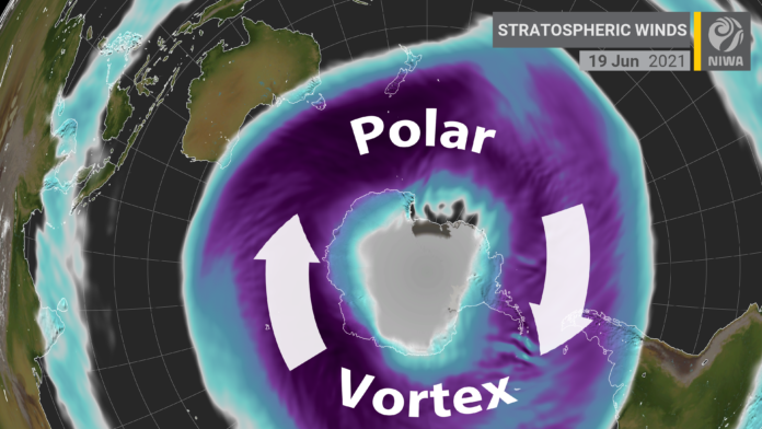
Mr Noll said the warmth was also due to a stronger-than-normal polar vortex. “This is an expanse of cold, stormy air over Antarctica that has been particularly efficient at preventing outbreaks of cold air into the Southern Hemisphere mid-latitudes, especially in New Zealand.”
Up until June 20 the nationwide average temperature was 10.97ᵒC, well above the long-term average of 8.59ᵒC.
“If the month ended today, it would become the country’s warmest June on record, according to NIWA’s seven-station series,” Mr Noll said.
The highest temperature was 22ᵒC at Leigh on the 19th and there are now more than 80 locations tracking toward a record or near-record warm June including Kaitaia, Whangarei, Auckland, Gisborne, Whanganui, Palmerston North, Wellington, Nelson, Greymouth, Hokitika, Milford Sound and Wanaka.
Mr Noll is predicting an unseasonably warm weekend coming up with mild nights in the 10-15˚C range and daytime temperatures possibly exceeding 20˚C in some places in the north and east of both islands. But, depending on your location, the warmth won’t necessarily come with dry weather.
Heavy rain in Fiordland and the West Coast on Friday and Saturday could cause flooding and slips, resulting from a plume of tropical moisture extending down from southern Indonesia. Strong northwesterly winds will buffet the Alps and race through the Cook Strait and Wellington on Saturday and Sunday.
A surge of freezing air from the Southern Ocean could approach the country from June 28 or 29, bringing a chance for snow to low levels and icy, strong southerly winds. A return to milder conditions is possible during the first week of July.
NIWA research has shown that New Zealand winters have been consistently shorter than they used to be.
]” title=””>


