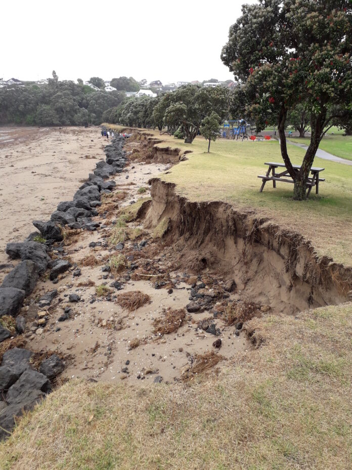
Source: Auckland Council
Coastal hazards such as erosion and flooding pose a very real risk to coastal communities around Tāmaki Makaurau/ Auckland. The impacts of coastal erosion and other coastal hazards will be influenced by our changing climate, including the effects of sea-level rise, and the decisions we make as Tāmaki Makaurau continues to grow.
To better understand the potential impacts of coastal erosion, Auckland Council has released a new report, ‘Predicting Auckland’s Exposure to Coastal Instability and Erosion’ that assesses the areas of Auckland that are susceptible to coastal erosion and cliff instability. The report explains the methodology used in a scientific study to estimate erosion rates for Auckland’s beaches and cliffs and includes regional-scale maps that identify which of Auckland’s coastal areas may be susceptible to coastal erosion and instability over a range of time periods.
Coastal erosion is the loss of land due to coastal processes, such as waves and tidal currents, wearing away land suddenly or slowly over time. This results in shorelines moving inland and makes cliffs unstable as the base erodes.
Councillor Richard Hills, chair of the council’s Environment and Climate Change Committee, says that uncertainty about sea level rise means coastal erosion rates have historically been difficult to predict.
“Our new Coastal Instability and Erosion report gives us stronger guidance using up to date data. The report identifies areas of Auckland’s coastline predicted to be susceptible to coastal erosion and instability with the findings giving us a high-level understanding of potential erosion rates across the region,” says Councillor Hills.
Why has the council undertaken this study?
The council’s Acting General Manager- Engineering and Technical Services, Paul Klinac, explains that the New Zealand Coastal Policy Statement directs councils to identify areas that may be affected by coastal hazards over a timeframe of at least 100 years.
“The council has requirements under the Resource Management Act, the Building Act, the Local Government Act and the Civil Defence Emergency Management Act to have a good understanding of areas potentially at risk from natural hazards like coastal erosion to support appropriate land-use planning and development decisions,” says Mr Klinac.
Mr Klinac says that the council’s new assessment builds on previous work from 2006 and provides a more thorough understanding of how Auckland’s coastal environment may change in the future taking into account sea level rise projections.
This research is similar to studies undertaken by other councils in New Zealand and brings us into alignment with nationally accepted practice.
What does the report predict?
Based upon recommendations from the Ministry for the Environment (2017), coastal erosion hazard maps for Auckland were generated based on 1.2 m of sea level rise over the next 100 years. The distance inland from the coastline that could be susceptible to coastal instability and erosion varies significantly across Auckland. Over the 100-year timescale modelled in the report, these distances vary from less than 20 metres in sheltered harbour coast beaches, to more than 200 metres for high cliffs like those along the open and exposed coast of Aotea / Great Barrier Island.
What are coastal erosion hazard maps?
“Coastal erosion maps provided in the report show the extent of areas that may be at risk of coastal erosion out to the year 2130 and include the impact of predicted sea level rise. They provide an illustration of a range of land instability and erosion distances for both cliff and low-lying shorelines along Auckland’s coastline,” says Mr Klinac.
“These maps show areas predicted to be susceptible to coastal instability and erosion. There are separate maps for each of the modelled scenarios over a range of timescales – 30 years, 50 years and 100 years. Cliffs and beaches are presented separately as the forecast erosion rates are based on different scientific models.”
How will the information in the report be used?
The council’s General Manager – Resource Consents, Ian Smallburn, stresses that the report is a regional scale study and says that the reports and modelling results apply to broad areas. He says he wouldn’t expect the report to be used as a reference in relation to specific sites (such as individual properties) without a more detailed assessment.
“Some people may follow up this work by having qualified professionals undertake site specific assessments,” says Mr Smallburn.
“This would provide a more localised assessment than presented in this study. As already happens, the council may request site specific studies for resource consent applications where development is proposed in a hazard area.”
In partnership with mana whenua and local communities, the council is also preparing coastal management plans (CMPs) with development of the region’s first CMP is about to start in Whangaparāoa. The coastal hazard data from this report will be considered during the development of CMPs.
Next steps
Councillor Hills reminds Aucklanders that this work is a very necessary part of understanding the impacts of climate change and expects an ever-increasing focus on these impacts moving forward.
The council is now converting these results into an online format which will be available on Auckland Council’s GIS system ‘GeoMaps’ by mid-2021.


